Hueco Tanks State Park & Historic Site

The Manling and I agree – Hueco Tanks has the best entrance photo opp of all of the parks we have seen, thus far. And this is technically before you even enter the state park proper! Once you enter, it’s a whole different level of awesome at Hueco Tanks State Park & Historic Site! But I’m getting ahead of myself in my enthusiasm to share our experience. Forgive me.

First stop once you enter the park is obviously the HQ to register your vehicle with the Park Staff at which time you will learn that there is a mandatory video for all park visitors before you can explore the park. Let me silence your groans by saying, it is a very engaging video. Super informative and even if you could skip it, I wouldn’t recommend that route because we learned so much in such a short period of time because of that mandatory video. Like, how to pronounce Hueco Tanks. What Hueco Tanks are. The history of the pictographs and graffiti in the park, and so on.

HTSP&HS is all about two things: history, and rock climbing. We were eager to start both, so once the educational video was done, we headed toward the big attraction – the boulders. You see, HTSP&HS isn’t a mountain. There are plenty of those. One of the things that you immediately notice about HTSP&HS as you drive toward it is that it looks like a collection of rocks, all stacked as if the Jolly Green Giant had been collecting them and was called away suddenly, leaving them in a giant pile. And as such, they beg to be explored!

Most of the trails are in full West Texas sun, which is abominably hot in July. The few shaded portions like this one are Godsends.
The paths are also well marked and maintained, which is good because there is no off-path exploration allowed.

There were different sites that skirted the North “Mountain” at ground level, which was the only portion of the park visitors were allowed to access without a guide, and we visited just about all of them. Unfortunately, we didn’t notice much more than graffiti. Definitely nothing discernible as original cave paintings to our untrained eyes. After looking for over an hour, we reluctantly gave up the search for these historical leavings in the searing heat of mid-afternoon. Deciding then would be the perfect time to climb rocks that had been baking in the early afternoon sun, we headed up the North “Mountain” for some bouldering fun.

Use the chain railing provided in the steeper parts. Losing your footing on the boulders would ruin your day. I know because I didn’t see them until our descent.
The Manling graciously gave me some “privacy” to compose my “feels” by looking in the opposite direction when I began to groan about every ache and pain my geriatric body was experiencing up the boulders. The sight of those cooler temps rolling our way did a lot to wash away my angst.

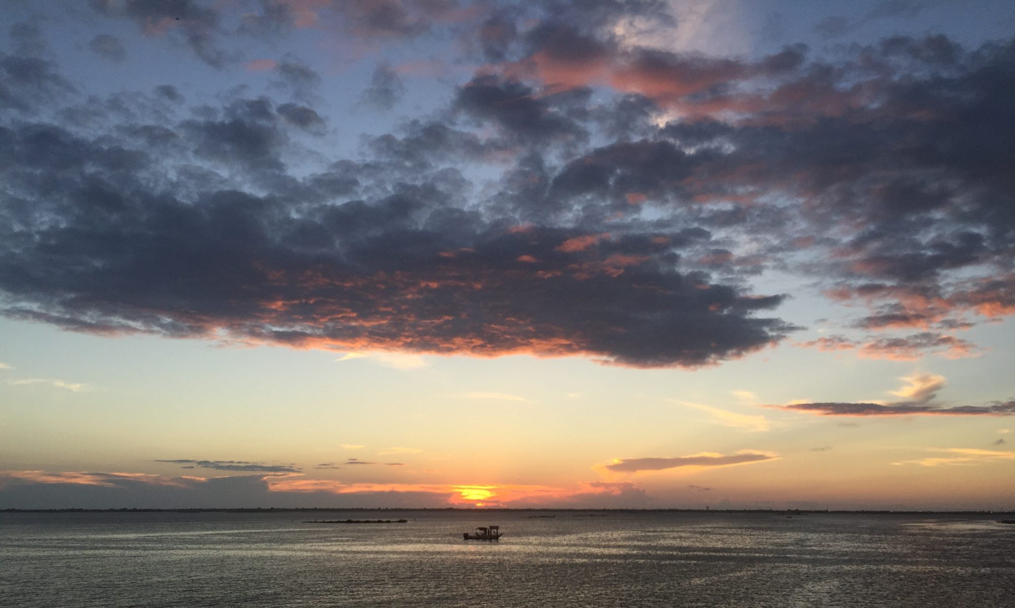
Two things happened on our ascent: 1) I had a mini-meltdown because it was way harder than it looked to climb those boulders, especially not having seen the handy-dandy rails to aid said climb of the steeper sections, and I was just trying to keep up with The Manling (who is in the prime of his youth) while I was carrying an umbrella to serve as both a piece of portable shade and an anti-snake device and, of course, my phone so that I could photo-document our experience; and 2) a glorious summer thunderstorm began brewing just to the west of us (see photo above) which provided the exact amount of cooler temps and refreshing breezes needed to galvanize me for the remainder of the climb. Seriously, it was just what the doctor ordered, those winds.

Eventually we made it to the top, which reminded me of that little bit of oasis from the end of the movie HOLES. We explored and enjoyed the wind and cooler temps it brought with it before we headed back down the boulders, this time with the aid of the blessed chain rails.

We headed back to the Interpretive Center to make sure we’d explored all we were going to explore on their humongous 3D terrain map thing since we still hadn’t spotted the famed cave paintings, when we met Charlie the Intern who took pity on our fruitless searching and ended up treating us to an impromptu personal tour behind the Interpretive Center.

I spy time! Even with Charlie the Intern pointing it out, do you see anything? We didn’t either.

I confess, we still saw nothing until Charlie the Intern pointed them out to us. Some of them were so light as to be barely discernible, but Charlie the Intern had a great $20 app on his phone that changed the resolution of photos and once he took a photo and manipulated it so that we knew what we were looking for, it felt like one of those Magic Eye stereogram moments that were all the rage in the 90’s. We finally saw them!

Make sure to climb up the overhang to the right in order to see the pictographs further in the back like The Manling did with Charlie the Intern.

After Charlie the Intern schooled us on what we were looking for, we retraced our steps to Site 17 and all that we had discounted earlier as just graffiti (which has been a problem in the park), became clearer to us. (Essentially, it boils down to this – There are the original cave paintings done many, many years ago. Then there are “engravings” that some disgruntled cowboys did in the last century on top of some of them. And there are also places that have been graffitied in more recent years. You can read more on the park’s History page.)

The off-white lines that look like a rib cage? That is the original cave painting. The name and date is the engraving done into the rock on top of the originals by a disgruntled Francisco, according to my understanding. Tsk, tsk, Francisco. You’re better than that.
While fascinating to see the names and dates, those are (again) meant to deface the original cave paintings by cowboys with attitude.
Look carefully. That is a cave painting, though honestly I have no idea of what. A snake maybe? A braid of gray hair?
This one I like. It’s a snake. Well, I don’t like snakes, but I like that I can see this one and discern what it is.
Close up of the HORSE cave painting that Mr. Wayland defaced in 1884. Bad form, MF.

Why We Love Hueco Tanks State Park

  1. History. I’m a sucker for some history and Hueco Tanks has it in spades. Start in the Interpretive Center so you understand the history of the place before setting out for some first-hand experiences with yesteryear. Be patient. It may take a little longer to find yesteryear, but that makes the finding of it all the sweeter.
  2. Rock Climbing/Bouldering. Yes, please! We had an amazing time bouldering the North “Mountain” on our visit. Definitely would be difficult for those with physical limitations (as in, I honestly can’t fathom how it would be accomplished) and personally, I would be a little hesitant to take kids up to the oasis because of the steep parts of the climb.
  3. Staff. The Park Staff from the HQ to the Interpretive Center to Charlie the Intern were all experts in making our visit phenomenal.
  4. Opportunity. While the North “Mountain” is accessible for self-guided tours, the East & West “Mountains” are accessible for those with guides. The guides at the time of our visit charged a very nominal fee per person and there is a link on the website for scheduling those in advance. Likewise, you can boulder til the cows come home on the North “Mountain,” but to rock climb you need the help of professionals, which the website also hooks you up with. Check out both of those opportunities here.

Must Do’s

  • Mandatory Video. Hello? It’s mandatory, so obviously you must do it. But it’s totally worth a few minutes of your time. Trust me.
  • Boulder. Be smart and use the chain rails in the steep areas. They are there. Find them and use them. I could have avoided my mini-meltdown had I done that. These rocks provide some excellent bouldering opportunities!
  • Explore. Make sure you spend time at Site 17 as well as the cave behind the Interpretive Center. Climb the ledge. Sit a spell. Take in the history you’re witnessing. See if you can discern a story or theme. It’s historically awesome!
  • Hike. The trails are basically flat, short walks. They are wide, well-marked, and easily traveled. But take an umbrella for shade because it gets hot as Hades in the full sun.

We’d love to hear about your experiences at Hueco Tanks State Park & Historic Site! Please share your experiences at this rockin’ State Park in the comments.

*In all natural areas, you are a guest. Educate yourself on what lives in the areas before your visits, always talk to the Park Rangers upon arrival and take precautions so that your experiences end as positively as ours.

Enchanted Rock State Natural Area

I feel like Enchanted Rock State Natural Area is so phenomenal that I should just post pics and let it speak for itself.

Only, I won’t because we had such an incredible time there mid-June 2018 that I need to get out all my feels about it, so here goes. But first…

Enchanted Rock is full of boulders and rocks to climb and these three have that carpe diem thing down. This was shortly after sunrise, the best time to enjoy the park in the summer as far as I’m concerned.

Enchanted Rock was a place The Manling and I had originally planned to explore in early June on our first State Park road trip. Because of storms the night before that stubbornly lingered into the morning, we ended up postponing our visit because who wants to trudge through muddy trails or scale thoroughly wet granite, right?

Second time around, we scheduled an early morning visit over Father’s Day weekend with The Man and Kinder Frau in tow. When I say early, I mean really early. As in, I am usually the only one that sees this part of the day in our family – which is why when our iPhone alarms did their jobs at 5am, no one was feeling it but me. I had called ERSNA earlier in the week to see what time the gates opened (which, in many cases, is before the HQ opens) and was thrilled to learn we could enter the park as early as 6:30am, which is pretty close to sunrise in June in the Texas Hill Country. Since the HQ would still be closed at that hour, the friendly Park Staff spent time with me during my phone call to help me plan an excellent route for an early morning hike at her park.

Once we arrived and registered our vehicle at the self-pay station, we headed left toward the trail head for The Loop, located near the playground and tent camping sites. The Loop trail, which was blissfully wide (as the Park Ranger had promised), consisted of crushed rock and, for the most part, was a gentle ascent. The Loop trail soon made us forget our 5am woes with its breathtaking beauty bathed in the early morning sunshine. We chatted. We laughed. We photographed. We passed a few who were heading down, having slept in more primitive spots in the higher elevation. In short, we (ahem, “I”) was so diverted by the scenic views and sparkling conversation that I barely gave a thought to what slithery critters might be lurking in the crevices of the park…

…until we switched to the Echo Canyon Trail at Moss Lake, a narrower trail, but still do-able by my city standards. As we progressed on that trail and passed the lake, the trail seemed to morph into a narrower path that would occasionally open onto wide granite flats before narrowing further still.

Switching from the w i d e Loop Trail to the slightly narrower Echo Canyon Trail
Scenic Moss Lake
At this point, is this even still considered a proper trail?

We passed some areas where rock climbing was permitted (all rock climbers must check in at the HQ), which proved a great inducement for us to want to return to Enchanted Rock since we love rock climbing!

Eventually we made our way to the Summit Trail at which point The Man and The Manling took off, leaving Kinder Frau and yours truly to catch our breath and enjoy the scenery before following the menfolk.

I’m not sure in degrees how steep the Summit Trail actually is, but it is the great equalizer in a race to the top. Once Kinder Frau and I began hiking it, we soon caught up to the menfolk and began an almost choreographed ascent as Kinder Frau, The Man and I took turns as 2nd, 3rd and last while The Manling left us coughing in his dust.

After several “false summits” –

You know, when you look up and think you are surely about to crest the thing you’re climbing only to see that you were oh-so-wrong and you’d better just look down and focus on putting one foot in front of the other because if you undergo even one more disappointed hope that you’ve finally made it to the top, you may suffer a fainting spell like in ye days of ol’, which would be very, very bad because of math & science – ie. the aforementioned steep angle of the Summit Trail “times” the physics that would guarantee your speedy descent should you faint “equals” disaster –

we finally – nay, GLORIOUSLY! – reached the Summit of Enchanted Rock!

The 360 degree views of this land called the Texas Hill Country that I am, in fact, falling head-over-heels in love with…oh, seeing them as the mid-morning sun’s rays brilliantly broke through the fluffy clouds made my heart feel full and a smile spread across my lips. It was the kind of brilliant feeling that makes you want to hug your loved ones and feast your eyes on the spectacle before you – like when the Griswold’s are on the front lawn awaiting Clark’s Christmas lights, arms enter-twined, on National Lampoon’s Christmas Vacation. It produced exactly those kinds of warm and fuzzy feels.

Why We Love Enchanted Rock State Natural Area

  1. Hiking. ERSNA has almost 11 miles of beautiful trails. Talking with the Park Staff helped us choose which trails we would enjoy the most. (Basically The Loop on the left side of the map is more scenic; on the right side of the map is more shaded. Since we were there in the coolest part of the day, we opted for scenic and were not disappointed. From The Loop Trail, we connected to Echo Canyon Trail on the back side of the park to cut through the middle and connect to the Summit Trail to the top of Enchanted Rock on our visit. Our Park Staff could not have planned a better route for us!)
  2. The Summit. Not too many places in Texas are high. This is a huge selling point for The Summit. The views are gorgeous and the birds fly “beneath” you while you’re atop Enchanted Rock. Pretty cool.
  3. Rock Climbing. We love parks that offer rock climbers a place to do their thing “in the wild.” Huge kudos for offering several spots to climb. Just make sure you check in at the HQ before you begin.

Must Do’s

  • Arrive Early. This is a super popular park and because of that, they periodically have to close the park to more guests. Check the website before your visit and plan to arrive early – as in before they open early to have the best chance at getting in.
  • The Loop. Half of it is shaded; the other half is scenic. Seems like a win-win whatever the time of day. Make sure you carry enough water with you because it is over 4 miles in length.
  • The Summit Trail. It rocks! (Get it?) It is steep, it is full of false summits, but it is absolutely worth it. Your heart will love it, even if your calves complain. And consider trekking poles like these that I borrowed from a friend. I heard more than one fellow hiker complain that he didn’t have trekking poles when I passed by with these bad boys.
  • Echo Canyon. Unlike the part of The Loop we hiked, it is actually pretty lush in a lot of spots and completely seems like a different park. Plus, it’s where the rock climbing spots are located.
  • Moss Lake. While you cannot swim there and the park website doesn’t list fishing as a park activity, Moss Lake is really pretty and peaceful. Definitely makes for great photos.
  • Photograph. It’s beautiful at Enchanted Rock. Take lots and lots of photos. And then take some more. In my opinion, filter-free. It’s that gorgeous…naturally.

We’d love to hear about your experiences at Enchanted Rock State Natural Area! Please share your thoughts on this enchanting place in the comments.

*In all natural areas, you are a guest. Educate yourself on what lives in the areas before your visits, always talk to the Park Rangers upon arrival and take precautions so that your experiences end as positively as ours.