Martin Dies Jr. State Park has not one, not two, but THREE different units! It is ginormous!!
By the time we visited our 37th Texas State Park, we kind of figured we knew what we’d signed up for, and what to expect. We knew the drill. After visiting 36 State Parks, we had developed a kind of rhythm to it.
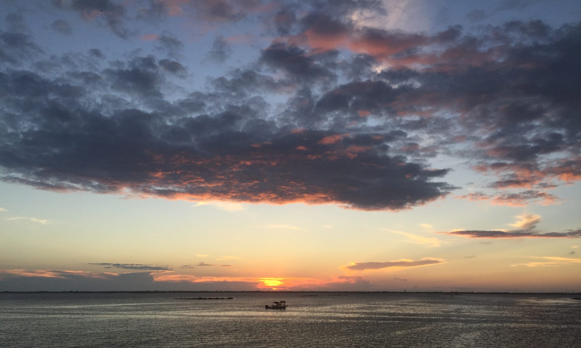
Let me start by gushing over how utterly gasp-worthy the drive to the HQ was when we visited in 2018. We’re talking towering trees lining the road, creating the most inviting and sporadically shaded drive that was akin to that scene in Keira Knightley’s version of Pride & Prejudice when she was visiting the Lake District with her Aunt & Uncle, riding along the English landscape, face upturned to the canopied trees, eyes closed, enjoying the bright bursts of sunshine through her closed lids that was punctuated now and again by the overhanging limbs. It was exactly that kind of beautiful drive that greeted us upon entry into the park that late summer day in mid-August.
The epic nature of that first introduction to MDJSP doesn’t really translate onto the screen. You’ll have to just trust me.
Maps in hand, we decided to do a scenic drive through of the park, get our bearings, and figure out where The Manling wanted to drop his first line in the water. We drove through what looked like a community of Little Houses on the Prairie. We passed countless camp sites, every one looking like it would be the best. We crossed over the quaintest bridge where we noticed a pontoon-type pier near the rental canoes. We saw open lake. We saw little inlets that looked freshly plucked out of Jurassic World. We saw and heard birds. We looked for ‘gators. We hiked part of the Island Trail. We saw the Observation Pier. Pretty much, we explored all the nooks and crannies MDJSP has to offer and came away with this: East Texas takes state parking to a whole different level!
The Manling doing a little fishing on the pontoon-style pier.
I couldn’t help being reminded of Parent Trap when I saw these. Love!An example of the stellar camp sites available at MDJSP.Campsite view of the lake under the shade of the towering trees. Bliss.Part of the beautiful Island Trail, a great example of the lazy paths through the tall trees, never out of view of the water.Cue the theme to Little House on the Prairie, please.The Manling feeling right at home. I think Lake Life is in his future.Love, love, love when the waters are covered like that. I don’t know what it is, but I do know that you can spot “alligator tracks” in them. Thumbs up!Seriously the best reflection pictures are available late afternoon just about anywhere in the park that the sun can shine through the trees.The Manling’s Mom totally appreciates the “sea wall” from which he got to fish. She’s not over fond of him being in the water when alligators call it home.I can feel the tension in my muscles relaxing just looking at photos like this. This is one of my happy places, I think.
I’m not going to apologize or make excuses because, truth be told, I needed this park, in this way, at this time. I needed to relax. I needed to allow the beauty and calm of the sights and sounds of nature to press the RESET button on my life. I needed a hiatus from the habitual business of life, and just Be. And that is exactly what MDJSP offered me. Respite. Peace. Breathing space. An intermission. A good ol’ fashioned time out.
Thank you, Martin Dies Jr. State Park. You were exactly what I didn’t know I needed.
Why We Love Martin Dies Jr. State Park
Log Cabin Village. Big fans of the Little House series, we adored the little log cabins available to overnight guests. They even have them with a/c. Simply irresistible.
Fishing. So many miles of shoreline. So many piers. So many places to fish.
Exploring. The trails absolutely rock. They have soft ground trails with towering trees overhead and a wealth of wildlife living in them. Try your hand a geocaching! In our opinion, it’s the BEST way to explore! Or grab your mountain bike for an afternoon on the trails.
Water. Two rivers converge where MDJSP is situated. Take to the water, especially if your visit happens during the six months of summer we seem to have here in Texas.
Alligators. Never saw one on our visit, but I gotta tell you, it’s exciting to look. Just the possibility of seeing one is an attraction in our book.
Camp Sites. Truly, The Manling and I kept spotting “the best campsite” around every corner. They are all magnificent and spacious, especially the ones that back up to the water.
Loaners. You can rent canoes, kayaks, and bikes. They even have a volleyball if the mood strikes that you can borrow for free at the HQ. I love that you don’t have to haul all of your own equipment. They’ve got you covered.
Must Do’s
Fish. There are a number of fishing piers and various places along the vast shorelines to drop a line.
Hike. So many easy trails on soft surfaces. Your dogs shouldn’t be barkin’ after exploring these.
Relax. Seriously, I felt so much lighter while we were at MDJSP. So peaceful. So beautiful. Such respite.
Stay. Whether in a cabin, a shelter, or a camp site, I honestly don’t think you could go wrong planning an overnighter at MDJSP. Picture perfect paradise.
We’d love to hear about your experiences at Martin Dies Jr. State Park! Please leave your comments on this picture perfect, peaceful, life reset below.
*In all natural areas, you are a guest. Educate yourself on what lives in the areas before your visits, always talk to the Park Rangers upon arrival and take precautions so that your experiences end as positively as ours.
God bless Park Staffer Kathy Smith. She has got to have the toughest job in the Texas State Park System at the time of this post. Why? Because her park was pretty much destroyed by Hurricane Harvey in 2017 and by the time of our visit in August 2018, it was still largely unusable. As in, the only areas open were the RV camping loop, the nature center, and the HQ.
Trails? Closed.
Picnic area? Closed.
Campsites? Closed.
Youth Group Camping? Closed.
Bike Trail? Closed.
Bridge to most of the park? Closed.
Canoe launch? Closed.
Village Creek? Closed.
No fishing. No tent camping. No exploring. No geocaching. No swimming. No playground. Just, no. All no.
And yet, Kathy was cheerful, super friendly, and eternally optimistic that the Texas Department of Transportation would soon have the bridge repaired so that the majority of the park could once again be accessible for repairs from the dreaded effects of Hurricane Harvey in 2017. {Fingers crossed for Spring 2019.}
So while I sadly cannot share first-hand experiences at Village Creek State Park, I can share with you what I learned from Kathy on the day of our visit while she was taking us on a walking tour of her park via the Park Map and that is this:
A creek flows one way all of the time (except for droughts, obviously); sloughs connect to larger bodies of water (like creeks) and their directional flow depends on the level of water in the larger body of water.
We talked about this because I noticed that Village Creek on the map looked like a river with a bunch of creeks running off of it, but Kathy was kind enough to explain to me the difference so that I left smarter than when I came. Village Creek is, well, a creek with a bunch of sloughs running off of it. Therein lay the problem when Hurricane Harvey hit last year, swelling Village Creek and consequently affecting her many sloughs that fed off of her.
Our thoughts and prayers are with you, Village Creek State Park. May you soon be able to open your gates wide to receive visitors within your boundaries once again. We look forward to making memories exploring your creek, sloughs, and trails sometime in 2019.
Why We Love Village Creek State Park
Park Staffer Kathy Smith. She was awesome! Only she could keep us riveted and engaged over a map. If you’re reading this Texas Parks and Wildlife, give that woman a raise. She’s your greatest asset!
Must Do’s
Revisit. Fingers crossed that she will be repaired and reopened by Spring 2019 so that we can actually experience her creeks and sloughs and trails in person. The map tour was good, but we look forward to the real deal.
We’d love to hear about your experiences at Village Creek State Park! Please flood our comments with a slough of your firsthand experiences at Kathy’s beloved State Park. (Too soon?)
*In all natural areas, you are a guest. Educate yourself on what lives in the areas before your visits, always talk to the Park Rangers upon arrival and take precautions so that your experiences end as positively as ours.
The Manling and I pointed the Tiny Toyota Tardis (because the Yaris is bigger on the inside) toward the Gulf of Mexico in the wee hours of an August 2018 morning, excited for a one-day getaway to a new-to-us, beachy destination in the southeast corner of the Great State of Texas. We arrived about an hour after Sea Rim State Park opened, profusely excited over two things – the probability of seeing alligators and the possibility of catching sharks. The Park Staff that we met in the HQ was an encouragement to us regarding the attainability of our goals and even shared a personal video that she had taken the day before of one of the local ‘gators crossing the road from the beach to the marsh side of the park. This one gesture served to fan the embers of our hopes and dreams, bursting them into a full-fledged fire on the spot. Next, she gave us tips on what other ocean anglers had used to catch sharks at SRSP and directed us to the nearest bait shop, unfortunately located ten miles east. Back into the Tiny Toyota Tardis we went, headed east toward a grocery store we “couldn’t miss” in Sabine Pass to buy both shrimp and mullet, the tasty treats that would {hopefully} land The Manling his first shark.
Bait acquired, we headed back to Sea Rim. We stopped by the Marsh Unit on the off chance that an alligator might be visible before we continued to the beach side of the park. We parked the car near the rental cabin and began looking, looking, looking.
Was that…?
Yes, lying completely still and silently observing us observing her near the kayak launch was a roughly 6 foot beauty! Apparently shy, she noiselessly disappeared under the surface of the water as we slowly approached, making the far away photo below the only evidence of our encounter.
Can you spy with your little eye our new friend?
With goal #1 accomplished before lunch, we headed to the gulf side of the park with a proverbial spring in our step to work on goal #2. We passed the HQ and steered the Tiny Toyota Tardis onto the beach – yeah, onto the beach – because at SRSP, the sand is so “packed” that you can actually drive onto it, even in a tiny, lightweight 2-door stick shift! From that moment forward, the world (or at least this beautiful, beachy portion of it) was our oyster!
SRSP boasts five miles of gulf front property and we, my friends, were the sole occupants. See?
Not a sole in sight to the east…
…nor to the west.
Once we set up shop for the day, The Manling got down to the very serious business of trying to land himself a shark. He fished for five straight hours while I read, relaxed, and simply enjoying the bliss of this shared moment in time at this special place.
Shortly after lunch, we headed to the Gambusia Nature Trail, an easy twenty minute trail through the marshes atop a genuine boardwalk. As in, the entire trail is a boardwalk through the marshes and since rumor had it that some of the alligators enjoyed sunning themselves around midday, we thought we’d take a peek. I was admittedly a wee bit cautious as we entered the boardwalk trail because of the au naturale condition that greeted us.
I persevered, however, around that curve to the right, through the super tall growth that I was afraid concealed some hungry ‘gators, and all the way to the first glimpses of water under our path. In other words, about 150 feet. Then I looked down into the water to the left just in time to see a snake swim out from under the boardwalk about four feet in front of me, at which point I decided to make a hasty exit.
Feeling exasperated by my phobia, I began to think of a way to conquer my fear and this trail. It was then that I spotted my new best friend, Marie, enjoying a picnic lunch with her husband and sweet granddaughter. Before giving it any thought, I walked straight over to them and asked if they were, by any chance, planning to walk the boardwalk trail after their picnic. Reader, I visibly exhaled when she answered that they were and agreed to let us tag along – a little Colorado Bend State Park déjà vu for the win!
Totally stoked, I left Marie and family to finish their picnic in peace. I walked back to the Toyota to inform The Manling of the good news, at which he may have rolled his eyes in exasperation. But, he let it lie and just rolled with it. This wasn’t his first time at the rodeo.
Long story short, Marie and her daughter had a fabulous time walking, skipping, and basically just enjoying the sights and sounds of the birds, the fish, and a couple of times, me. I was on Mr. Marie like white on rice. The poor man practically wore me like a knapsack as we strolled casually around the 3/4 mile boardwalk, which in places seemed a little too on the rickety side for my preference. Nary an alligator did we see, sunning itself or otherwise. I did look up from my frozen view of Mr. Marie’s shoes a couple of times and was treated to some breathtakingly beautiful scenery.
Photo Credit: Marie, who shared this photo she took of her blessed husband and The Manling dutifully flanking me like we were the British on patrol during the Revolution.
Since the rest of the trails were all paddling trails (and we didn’t ask the Tiny Toyota Tardis to shoulder the burden of carrying the kayak, which would definitely be a picture-worthy sight), all that was left on the agenda was to live in the moment on the beautiful bit of beach we had claimed while The Manling continued his quest for goal #2.
Catch-and-release
While The Manling landed one fish after another, in the end a shark was not counted among them. I did a very little bit of exploring on my own (mainly the Dune Boardwalk), and spent the rest of our time at Sea Rim State Park savoring the memories I was making with The Manling from the comfort of my camping chair.
As all good things must, our magnificent day at SRSP came to a close- just as a summer storm crested the northern horizon behind us.
That’s a big storm brewing behind the Tiny Toyota Tardis!
On our way out of the park, we stopped by the Marsh Unit one more time on the off chance that we might see another alligator, which proved the perfect way to end our time at Sea Rim State Park on a very high note.
Can you see that big, beautiful head in the water?
Why We Love Sea Rim State Park
Water. Texas summers should always, 100% of the time, equal water. It’s hot as Hades here. Water makes it bearable. The steady breeze off the waters of the Gulf aren’t too bad, either.
Fishing. The fishing was excellent and even though The Manling didn’t land his first shark, he had a stellar day doing what he loved. It’s always more fun catching when you go fishing.
Alligators. I have a morbidly curious fascination with the alligators in Texas, especially in the State Parks. And we saw TWO this day! Score!
Uncrowded. The location (which is remote) is the only sense that I can make of the place being so unpopulated. But hey, that’s our jam! We loved feeling like this was our private piece of paradise for the day!
Must Do’s
Fish. Grab some mullet and shrimp before heading to the park. That grocery store in Sabine Pass 10 miles to the east can hook you up. Then park your keister on the beach for the day, reeling ’em in til your heart is content.
Relax. The park is situated in a pretty remote place, which seemed to be the only reason it was uncrowded on our visit. You can do some serious de-stressing on that underpopulated stretch of Gulf coast. You’re welcome.
Nature. Enjoy the sea birds. I literally watched their shenanigans for hours. Go on an alligator hunt – just keep your distance and don’t be a fool. Those things are completely wild. Exercise caution.
We’d love to hear about your experiences at Sea Rim State Park! Please share your experiences at this uncrowded piece of paradise in the comments.
*In all natural areas, you are a guest. Educate yourself on what lives in the areas before your visits, always talk to the Park Rangers upon arrival and take precautions so that your experiences end as positively as ours.
The Manling and I visited Abilene State Park in July 2018. It was our first visit to this gem, even though it is only three hours from our home in North Texas. En route, I hunkered down for some alone time in my favorite space – my head – while The Manling reposed in the passenger seat of the Tiny Toyota Tardis (because the Yaris is bigger on the inside). As the road changed from interstate to a two-lane road, the scenery morphed. I exchanged the flat expanses of I-20 for sublime roads more akin to roller-coaster tracks filled with hills, valleys, twists, and turns. No longer was I staring across level fields of wind turbines. I was now delightedly driving through miles and miles of them as I wound my way ever closer to Abilene State Park.
The Manling had been awake all of 60 seconds when we snapped our entry selfie. God bless him.
While registering our visit with the Park Staff upon arrival, we chatted both of them up about their park, attempting to extract from each what they personally considered top notch V.I.P. experiences within ASP. Their suggestions combined with the plethora of activities listed on the website greased the wheels of my imagination for a fall camp out with friends, from which the gears have continued to spin. From this ceaseless planning, I have created:
Abilene State Park’s Top 10 Activities for Every Person on the Planet
10. Swimming. Open during the summer, ASP offers park goers a ginormous swimming pool, a smaller wading pool, tons of seating, and even shaded lounge chairs to make for an epic poolside day of fun in the sun (or shade). The perfect cure for the Texas summer heat.
9. Bird Blind. Lots of State Parks provide special areas for guests to enjoy the sights and sounds of their winged visitors, but ASP went a step beyond with their bird blind. We could actually hear the wings of several hummingbirds from our vantage point, as well as the happy chirping and singing of several other varieties of birds visiting their favorite, shaded, protected watering hole. Delightful!
8. Horseshoes. Nestled under glorious shade trees near the pool and beautiful CCC-constructed water tower are actual horseshoe pits! As in, good ol’ fashioned fun from yesteryear!
7. Kayak/Canoe Rental. Rentals are available in the park’s HQ for kayaks and canoes, a fun way to explore Lake Abilene during your visit.
6. Team Building Game(s). Sand volleyball. Soccer. Baseball. Kickball. There’s space for all of these fun team building games at ASP! Grab some friends and bond over a competitive sport…or two!
5. Fishing. There is a pond on the HQ side of the park, but there’s a lake across the road surrounded by the beautiful rolling hills of the Callahan Divide. The whole time you’re fishing, you’ve got the sneaking suspicion that you are actually somehow fishing on the planet Mars with the beautiful orange terra firma beneath your feet.
4. Trails. With around five miles of them, you could legitimately see the entire park by foot over the course of a weekend. Some are bike-accessible, too! The ones we trekked on our visit were beautiful with canopied trees, lush undergrowth, and a variety of birds providing an enjoyable soundtrack while we explored.
3. Sunset. Lake Abilene at sunset. Trust me.
2. Geocaching. There were a few free geocaches within the park and I have to give kudos to the brilliant blokes that hid them. They were FANTASTIC! I may sound like a broken record, but geocaching is the best way to explore a new area. Download the free app and go have fun modern-day treasure hunting!
1. Staying. This is number one because of the variety of wonderful, picturesque, and one-of-a-kind accommodations available at ASP.
Tent camping? yes
RV camping? yes
Lakeside Cabin? yes
Tiny House Village? yes (a.k.a. shelters, but they look like an adorable tiny house village set underneath the trees!)
YURTS? oh my, yes! (Sign me up for an overnighter in a bona fide yurt complete with beds and an a/c, please!)
Why We Love Abilene State Park
Location. I mentioned driving through miles and miles of twisty-turny, up-and-down roads through the towering wind turbines en route to ASP. When we left, we were treated to the likes of Buffalo Gap, a precious little piece of ‘Merica that will make you want to listen to Lee Greenwood sing “Proud to be an American” on a loop while you explore it via the geocache method of tourism.
Variety of Activities. Boating. Swimming. Horseshoes. Team Sports. Fishing. Hiking. Biking. Bird Watching. Geocaching. Exploring. It’s all there for the taking, friend.
Accommodations. Yurts, people. Yurts with a/c. And if that isn’t enough, shelters that look like a Tiny House Village nestled under beautiful trees. If those are too primitive, there’s a legitimate Lake House Cabin. Or if you are so inclined to bring your own accommodations, the tent or RV sites are picture perfect.
Must Do’s
Um, see the above list.
We’d love to hear about your experiences at Abilene State Park! Please share your experiences at this deliciously divertingState Park in the comments.
*In all natural areas, you are a guest. Educate yourself on what lives in the areas before your visits, always talk to the Park Rangers upon arrival and take precautions so that your experiences end as positively as ours.
We first met Mater when we visited Lake Colorado City State Park about four years ago, chillin’ in the field across from the park entrance. We waved a friendly “hello” as we headed home after a few hours at the park, glad that he’d come to see us off that uneventful day. Uneventful in the truest sense because our first visit to this self-proclaimed desert oasis was kind of a dud. Not only was the park desolate in an eerily creepy kind of way, the park was in the deep, dark part of a severe drought at the time and what was left in it’s wake looked to our eyes like the aftermath of an apocalyptic event. Mangled docks looked like a shockwave had rendered them completely unusable and almost unidentifiable had they not been standing so tall on parched ground that was, in former days, the lake.
Imagine our surprise when we saw Mater again during our revisit mid-July 2018, sitting in the same spot across from the entrance to the park, reminiscent of the good ole days when hard working folks sat a spell on the porch, sipping sweet tea, enjoying the gentle breeze of the summer evening after a long day of sweaty labor on their land. Love.
Kinder Frau, The Manling, and me – circa 2014
But there ends any similarity between our first visit and our second.
On our second trip to LCCSP, what we happily discovered was a park slowly, but surely, recovering from the devastating effects of years of drought. The fishing piers that were formerly disfigured and damaged by the drought were replaced with sturdy, robust piers that hosted a small, but continual rotation of anglers eager to drop a line in the water, which now delightedly covered the ground under them once again.
Where the park was desolate years before, we now encountered a handful of families both in the RV camping area and using the lakefront, air conditioned shelters, all of which look like newly build tiny homes complete with shaded front porches.
On our first visit, the lake was deserted, unused. On our more recent visit, we crossed paths with a family setting up a canopy in preparation for a day in the sun and surf once again available at Lake Colorado City State Park.
On our first visit, our imaginations were stirred for hours, imagining various scenarios that could have caused the undisclosed apocalyptic event. On our revisit, our minds were engaged geocaching. The park has a couple of great finds, by the way. And this is a great way to explore the park on foot for singles, couples, or the whole family.
While we restricted our explorations to the main roads on our first visit, this second time around Park Ranger Sky encouraged us to discover the roughly 1.5 mile (round trip) of bike trail they have been working to clear.
This park that was once fodder to spark conversation and creativity, is slowly becoming one that we can imagine will again hosts hoards of West Texans seeking to escape the heat in the cool waters of Lake Colorado City, on the cusp of becoming a desert oasis once more.
Why We Love Lake Colorado City State Park
Mater. I know he’s not technically a part of the park, but he has been a part of our park experience both visits and we love him. Make sure to wave a friendly “hello” to him when you see him.
Water. It’s hard to not hit a home run during the Texas summer heat when water is part of the equation. Thankfully, LCCSP is making a comeback in that department.
Fishing. Boat docks and fishing piers in the early morning and evening are the best times to drop a line.
Geocaching. There are one or two in some pretty ferrel areas, but there is one that is hidden in a truly spectacular location. Let the treasure hunting begin!
Trails. The trails were still under construction while we were there, but they are already taking shape and I think they will be pretty awesome either on foot or by bike in the near future.
A/C Shelters. I’m a sucker for tiny homes and these cute little shelters with a/c look like a newly built community of them, all lakeside. Bonus!
Must Do’s
Geocache. Hands-down, I think this is the absolute best way to get up close and personal with a new area. State Parks included.
Fish. The Manling wasn’t able to catch much on our visit, but we were there during the middle of the day. He will definitely try again the next time we are at LCCSP. You can count on it.
Swim. The water is making a comeback. A family was enjoying their floats on the water when we were there. Dip a toe in.
Stay. Tiny homes. RV’s. Even tent camping (in a more hospitable time of year). LCCSP can accommodate all budgets and preferences.
Explore. The trails look like they will be nice, wide, level trails for mountain biking…or exploring on foot. I’m especially psyched to try the one that runs adjacent to the lake. That promises to have some pretty great views.
The landscape as you drive I-20 in West Texas is flat. Really flat. It is literally mile after flat mile of basically the exact same view, which isn’t necessarily bad. It can, however, become monotonous. Which is why you take the five minute detour when you see the one raised portion of earth in Big Spring jutting out of it’s utterly flat surroundings.
We have visited Big Spring State Park twice now and both times it served as a fabulous diversion from the monotony of travel and lent fresh eyes to the vastly flat West Texas landscape. Our first visit was years ago in the heat of a hot Texas summer afternoon. Even with the soaring temps, BSSP was sprinkled with locals walking pets, running, and hiking it’s winding incline. Our second visit in mid-July 2018 was just after the gates opened at 8am and it was again populated by locals getting their exercise on during the cooler part of the day. Young. Old. Two-legged, or four. Everything in-between. BSSP is absolutely loved by the locals and even the hottest day of the year doesn’t keep them from enjoying their park.
And here’s why –
Why We Love Big Spring State Park
Free. That’s right. Visiting this Texas State Park is absolutely FREE. You literally have nothing to lose and elevation to gain. Go for it.
Views. Appreciate the vastness of the West Texas landscape from the Big Spring State Park vantage point – 200 feet up!
Inspiring. If you need motivation to get moving, look no further than the parking lot of BSSP. The cars arrive before sunrise to claim one of the limited spots at the bottom of the bluff while its inhabitants get their exercise on. Walk your dog. Hike. Run. You will be inspired toward fitness at BSSP.
Must Do’s
Early or Late. You’ve got to treat yourself to a spectacular West Texas sunrise or sunset. Just mind the times the gates are locked.
Hoof It. Walk your dog. Hike. Run. Just get out of the car and experience BSSP the right way – on foot!
We’d love to hear about your experiences at Big Spring State Park! Please share your thoughts on this State Park that is loved by the locals in the comments.
*In all natural areas, you are a guest. Educate yourself on what lives in the areas before your visits, always talk to the Park Rangers upon arrival and take precautions so that your experiences end as positively as ours.
Monahans Sandhills State Park was a State Park that I had wanted to visit for years. I first read about it in a magazine that revolved around travel within the great state of Texas when The Manling was a wee little tyke. I remember sharing what I’d read one night as the family ate dinner at an On the Border with my sister and niece, and from the first mention of sand boarding, the entire table was excitedly planning a family vacation to Odessa, Texas, to experience the awesomeness firsthand.
Life got busy.
Years passed.
My sister and niece moved.
Nary a thought was given to those sandhills at MSSP until our Tour of Texas Waterholes, which couldn’t be complete without including the world’s largest spring-fed swimming pool, happily situated in Balmorhea State Park, an easy hour or so drive from Monahans Sandhills State Park! Sand surfing was back on the menu!
Our first visit, circa 2014Great exercise was had climbing those sandhills!We began the day with our own sleds, but soon enough we’d worn through them. Thankfully the HQ rents them for a nominal fee for the entire day.Once we mastered the sit-and-slide, we were eager to test our skills at sand surfing.We rented a board from the HQ and took turns sand surfing.We had mad skills by the end of the day!
Fast-forward back to our visit in mid-July 2018. With our recent heat-related incidences first at Franklin Mountains State Park and again at Wyler Aerial Tramway still fresh in the rear-view mirror, we opted to spend the cooler golden hours at MSSP on our return visit. The Man had reproduced some pretty stellar pics of an epic Star Wars shot involving two moons years ago at MSSP and The Manling was eager to attempt the same this time ’round. We trekked and explored the dunes searching for just the right angles and exposures and silhouettes until the sun {literally} didn’t shine no more.
We ended the day standing atop a dune, silently admiring the awesome beauty that is painted across the stretched canvas of the enormous West Texas sky.
Why We Love Monahans Sandhills State Park
Sand surfing. This State Park knows the recipe for making lemonade out of lemons because what else are you going to do to pass the time on a bunch of sand in the middle of nowhere except sand surf?! This is legit fun.
Dunes. Deserts in Texas are flat. You can see for miles and miles. At Monahans Sandhills, you get the feeling of being transported to a more exotic desert, like the kind you’d see in movies. They’re pretty cool that way.
Sunset. Best sunsets. Great photo ops.
Must Do’s
Sand surfing. Seriously. Rent one and go play. This is where it’s at.
Sunscreen. Trust me.
Sunset. Spend the golden hours in the evening there. Take a picnic and just sit and enjoy a nice, slow sunset with spectacular color rivaling Joseph’s technicolor dream coat.
Play. There is a circle drive at the end of the park road that we saw some grown men enjoying with their heavy-duty remote control cars. It was cool to watch, so I imagine it would be even more fun to do.
Camp. Spot #10 is the bomb with your own private dune right behind your campsite!
Isn’t site #10 spectacular?!
We’d love to hear about your experiences at Monahans Sandhills State Park! Please share your experiences at this sandy State Park in the comments.
*In all natural areas, you are a guest. Educate yourself on what lives in the areas before your visits, always talk to the Park Rangers upon arrival and take precautions so that your experiences end as positively as ours.
First of all, the road to the parking lot of the Wyler Aerial Tramway could be kissing cousins to the Crookedest Street in the World in San Fransisco. It was steep from the very beginning with incredible switchbacks that made driving our two-door stick shift an off-the-charts kind of adventure. Kudos to the planners that engineered that paved piece of paradise!
Secondly, from the moment we got in line to ride the Tramway to the top of Ranger Peak, The Manling and I were treated like V.I.P.s. Those tiny little trams tote a great many people up and down Ranger Peak all the livelong day and in order to do that efficiently, they occasionally combine parties for the ride. Such was our case. Shortly after we joined the lengthening line to patiently wait our turn at the bottom, we heard a call for “any two-person parties” and quickly raised our hands. As we made our way forward, apologizing to the crowd, we were legitimately boo‘d. I think they were kidding, but if they weren’t, I totally get it. It was a thousand degrees and we were cheating the system that they had obediently followed. (Not only did we get to skip the line like V.I.P.’s on the way up, we also got to skip it on the way down – but I’ll tell you about that later. Wait for it.)
Even though we both suffer from a serious fear of heights, that ride up to Ranger Peak was spectacular. It was Standing Room Only in our tiny tram (because there is only one seat and it is reserved for the Tram Operator), which we shared with a sweet Grandma and her five young grand-minions. It was an ideal scenario, really, because everyone was so short-of-stature that we enjoyed 360 degree unimpeded views over their wee little heads (Grandma included).
Once at the top, we read all the signage in a quest to properly orient ourselves so we could fully appreciate our mile-high vantage point.
Mexico? Check.
Army base? Check.
Airport? Check.
This mountain? Check.
That mountain? Check.
Rio Grande? Check.
Border crossing? Check, check, and check.
Next, we made our way to the Souvenir Shop to get a Park Map because we, my friends, were planning to hike to the Crash Site. What Crash Site, you may ask? I have no idea, but it sounded like something that would happen in Roswell and that was just too cool for us to take a pass.
In order to do that, however, for the first time in my life, I had to get a bona fide hiking permit. The area the commoners are allowed to walk around at the top of Ranger Peak is small. And gated. Not really intended for extended visits. Kind of a treat-em-and-street-em scenario. You actually cannot physically touch the mountain while you’re on top of it because it’s all platform and souvenir shop and machinery…unless you secure hiking permits. And we had them. I confess that I was high on my own importance as we walked purposely toward the gate, threw it open, and boldly walked passed the RESTRICTED ACCESS sign and onward toward our adventure amid the wide-eyed stares of the more ordinary folk.
Now let me backtrack for a sec because Ranger Eddie (who, in my opinion, seemed unnecessarily concerned for our welfare at the time) drilled into us this important advice before we headed out on our 1-1.5 hour hike: take a lot more hydration with you than you figure you’ll need, and constantly orient yourself via the Tram Stop at the top of Ranger Peak. Do those two things, and you should be a-ok. Oh! And watch your footing, so I guess three things. Seeing as our surplus of water was back down in the parking lot in the Tiny Toyota Tardis (because the Yaris is bigger on the inside), we concluded we had enough in our packs for such a short hike. After all, Eddie didn’t know us, or our mad hiking skills.
I tucked the map into my back pack because WE GOT THIS, MAN. Plus, The Manling is an Eagle Scout and they know how to orienteer their way out of a black hole, so I was set to just enjoy the views and the company for the next hour or so.
The beginning of the trail was a series of descents to where the trail actually evened out, more or less, as it encircled Ranger Peak. I was feeling pretty smug and superior as we alone made our way along the trail Ranger Eddie had pointed out from the the Tram Stop above.
Yeah. Real climbing went on to get to the mostly even trail shown in the next pic.This right here. This is what Ranger Eddie pointed out to us from above – a nice, obvious path. What could go wrong?
I was also beginning to feel lightheaded. The cure, I discovered, was to look at the ground a few feet in front of my feet, so that is how we made our way around the mountain, Jesse in front talking and navigating us while I brought up the rear, head angled down. Occasionally we stopped so that I could take in the view or snap some pics, but for the most part, we continued toward the Crash Site Overlook in this fashion until…
I looked up and realized we were almost to Guardhouse #2. Which is on a different trail altogether. The Tram Stop – that was suppose to faithfully remain to our right en route to the overlook – was now directly behind us. My shoulders sagged a little, remembering that this was what Ranger Eddie had warned us not to let happen. Sigh.
After a quick call to Ranger Eddie in the Souvenir Shop, we retraced our steps back up the mountain, searching for the signage that would direct us back onto the proper trail and sucking down a lot of water in the process because mountain climbing in the July afternoon heat in West Texas is dehydrating, to say the least. Eventually we spotted this –
Yo, Eagle Scout. How did you not see this sign? “I was enjoying the view.”
– at which point I may have collapsed to give my shaking legs a much-needed break from the vertical climb while I sucked down even more H2O, and, at which point, The Manling informed me that we were on our last two bottles. Drats! We both knew we could not make it to the Crash Site Overlook on the water left in those two bottles, not if we planned to make the return trip. Reluctantly, and with heads hanging a little lower in disappointment, we began the slow hike back to the top of the peak.
I’m going to spare you the long and arduous return trip except to say that we lost the trail THREE. TIMES. Yes, THREE more times we climbed up higher than we should have before retracing our steps back down, or we went lower than we should have before having to reclimb our way back up to the trail, and we only had that scant amount of water left and at this rate, we were surely not going to make it back unassisted, so eventually my feels about all of this had to come out and I cried – A LOT! – which may have exasperated The Manling because he doesn’t yet know how to process a grown woman crying out in despair.
At one point I asked The Manling to please, please, please say something to encourage me. “How about one of those verses you learned in AWANA? Gimme something to hold on to!” He paused and then said, “Even though I walk through the valley of the shadow of death, I will fear no evil…” to which I replied, “No! No! No! Not that one! I was thinking something along the lines of ‘I can do all things through Christ Who strengthens me or something!'” to which he replied, “Well, that was the only one I could think of right now.”
I remember at one point trying to calculate how much it would cost The Man if we had to have a helicopter rescue off that mountainside because I felt like I literally could not climb one more step.
And, to add insult to injury, I felt like I was about to hurl!
Eventually, my shaking legs did make it back to the top and they somehow deposited me into the air conditioned Souvenir Shop where I unceremoniously claimed a spot on the floor by the collector’s coin machine that takes a penny and smooshes it with an “engraving” of the place you’re visiting, at which point a Park Staffer (Nicole) came to render me aid. After getting cold, wet towels on important places on my body to help lower my internal temperature, Nicole called down to the bottom to have the snap towel in the freezer brought up on the next gondola for me. While she was doing this, The Manling bought me a pretty gargantuan-sized Gatorade – on his own dime.
Did I mention I was wearing all black while we hiked in 100+ degree heat, including running tights?
Eventually, and after everyone was satisfied that I could walk to the gondola unassisted, I was escorted to the front of the line for the second time that day. And you know that one seat that was reserved for the Tram operator? He gave it to V.I.P. me.
Why We Love Wyler Aerial Tramway State Park
Gondola. Those things are so cool! It takes about four minutes each way, but they are four very thrilling minutes! The Tram Operator directs your attention to various sights and cool information like the fact that both trams go at the same speed, but the other one will always appear faster. This ride is well worth the cost of admission.
Views. There is signage all around the viewing deck at the top of Ranger Peak that helps you discern where certain things are located. Like Mexico. Pretty cool! And being a mile high, there’s a lot to see up there!
Park Staff. Bless ’em, one and all. From Eddie talking to us about the serious nature of hiking in the heat around his mountain to Nicole swiftly rendering me aid to the Tram Operator who yielded his seat, they are all top notch in my book.
Trails. Man o man, do they ever have some doozies at WAT! There is one that even starts at the parking lot and climbs ALL THE WAY TO THE TOP. That’s some serious climbing! There are others that wind their way around the mountain, like the one we attempted. Word to the wise – the trails are loose rock on a rock mountain. Very tricky with the footing in a lot of spots. Wear grippy shoes and for the love of all things good, carry a TON of water.
Must Do’s
Tram Ride. Keep your cameras ready, this is a truly great experience and you’ll want to capture some of it on film. Plus, it’s the sole way to get to the top and those fantastic views, unless you plan to climb.
Hike. Please don’t let our experience dissuade you from some truly remarkable trails with unbelievable views because the next time we are in West Texas, we’re trying that trail to the Crash Site Overlook again. It was one of the best we’ve experienced, even though we didn’t conquer it!
Hydrate. Pack more water than you think you’ll need. And then double it. Truly, don’t suffer heat-related issues on the mountain. Take a ton of water with you. Just trust me on this one.
We’d love to hear about your experiences at Wyler Aerial Tramway State Park! Please share your experiences at this mile high State Park in the comments.
*In all natural areas, you are a guest. Educate yourself on what lives in the areas before your visits, always talk to the Park Rangers upon arrival and take precautions so that your experiences end as positively as ours.
We got lost. Waze, who had become our BFF on our West Texas Road Trip by navigating us through the middle of many nowheres for five days straight and diverting us around a parking lot situation on I-20 in Odessa on day one, kind of let us down on the day we pointed the Tiny Toyota Tardis (because the Yaris is bigger on the inside) toward El Paso’s Franklin Mountains by not intuitively knowing we meant the Tom Mays part of the park. On the flip side, she did get us to the HQ, which hooked us up with the likes of Erika the Office Manager and Ranger X (for Xavier – how cool is that?!) and they not only showed us how to get to the part of the park that we wanted, they also talked us through some great options once we got there. So, serendipity. (To aid you in your adventure, use this address in your map app – “Tom Mays Park Access Road” – to get to where the adventure is in Franklin Mountains State Park. It’s on the opposite side of the mountain from the HQ.)
FMSP is serious about mountain biking, offering a fix-it station at the Beginner’s Loop!
We mountain biked. I mean, we had burdened the Tiny Toyota Tardis with a heavy bike rack, our bikes, and The Manling’s fishing gear for days of driving up and down mountains, along rough dirt roads, across jarring cattle grates, and through stop-and-go big city traffic. And now, now we were finally getting to use them! Ranger X suggested the Beginner’s Loop to test our skills (because it was the most level), so that was our first stop. We figured we’d get a taste for what we were in for before we progressed to the more advanced trails. Ranger X did us a solid. The Beginner Loop is no joke, people. It was a barely discernible, teeny-tiny, twisty-turny trail through sharp cactus and over even sharper loose rock that caused us to skid and slide our way around it until I popped my chain. Twice. And got a flat. Back at the car thirty minutes later, we felt like we’d had a proper sampling of what mountain biking in West Texas was like and we were good. As in, done.
We paused at the entrance to the Beginner’s Loop to take in the spectacular view of the Franklin Mountains. Note: The beginning is the only wide portion of the trail you’ll see.
The Beginner’s Loop was the most level of all the trails, but it was a narrow, slippery ride that left me questioning my mountain biking prowess.
We hiked. We headed to the various trail heads next to get a sense of which one(s) we would tackle in the nearly-noon heat. Ranger X suggested we check out the Aztec Caves Trail or the Cottonwood Spring Trail. After a quick drive by of both, the Manling was feeling the Cottonwood Spring Trail. Since he was already feeling the effects of the heat from our mountain bike ride on the Beginner’s Loop, I just went with it, no questions asked. Long story short, we never made it to the lone cottonwood perched up on the rocky mountain’s side, clearly visible from the parking lot. And also clearly farther away than it looked, especially in temps that soared above 100 degrees. We made it about halfway before deciding that even if we continuously chugged the rest of our electrolyte-filled waters, that would not be enough to replenish our bodies for the remainder of the hike. We reluctantly retraced our steps back to the parking lot, the cold a/c of our vehicle, and drown our defeat in still more electrolytes in an attempt to recover from #4.
Heading up the rocky Cottonwood Spring Trail full of hopes and dreams
And heading back down the rocky Cottonwood Spring Trail, dehydrated and deflated
We suffered heat-related exhaustion. I don’t know how we could have prepped for a better outcome because we sucked down electrolytes all the livelong day like we were doing a paid endorsement, and we make sure our foodstuffs provided prime nourishment for our bodies so that they would be up to the tasks we asked said bodies to do. Maybe it was the time of day. Maybe it was the over 100 degree temps. Maybe it was the dry, West Texas heat. I don’t know. All I have to share is this, Be Aware. Heat exhaustion is real. When you go out and about and start to feel yourself struggle, Go Back. Live to adventure another day, my friend.
Why We Love Franklin Mountains State Park
Mountain Biking. If this is your thing, go for it! In my opinion, the trails are for experienced mountain bikers, including the Beginner’s Loop. Word to the wise – bring extra tubes because the rocks and cactus are sharp. You’ll need ’em.
Hiking. Excellent trails like the Cottonwood Spring and Aztec Caves await you. One thing I really liked and would make me return is that we never made it to our destinations. And you can see the caves as a gaping hole in the mountain from the parking lot and that kind of is an irresistible draw. Same for the Cottonwood Spring – you can see one, lone Cottonwood on the side of the mountain and you just HAVE to go to it. Wear good shoes. And drink plenty of electrolytes.
Park Staff. Office Manager Erika, Ranger X, and Ranger Geoff (whom we met in the Beginner’s Loop parking lot) were all top-notch human beings. Make sure to meet them and take advantage of their knowledge of the park to help plan your adventure in it.
Mountain Pass. Make sure you mistakenly start at the HQ so that you can ensure the drive through the Franklin Mountains pass, which was fun and beautiful and a little humbling when your car is struggling to the top, but totally worth it.
Must Do’s
Trails. They have long trails, short trails, bike trails, foot trails, even trails, steep trails. They have all of the kinds of trails you could imagine at FMSP. Go explore!
Hydrate. Talk to the Park Staff before your visit for suggestions on how to not have to cut your trip short like we did. It is seriously hot. And it is seriously dangerous to under-prepare. Educate yourselves before you go.
We’d love to hear about your experiences at Franklin Mountains State Park! Please share your experiences at this hot-to-trot State Park in the comments.
*In all natural areas, you are a guest. Educate yourself on what lives in the areas before your visits, always talk to the Park Rangers upon arrival and take precautions so that your experiences end as positively as ours.
The Manling and I agree – Hueco Tanks has the best entrance photo opp of all of the parks we have seen, thus far. And this is technically before you even enter the state park proper! Once you enter, it’s a whole different level of awesome at Hueco Tanks State Park & Historic Site! But I’m getting ahead of myself in my enthusiasm to share our experience. Forgive me.
First stop once you enter the park is obviously the HQ to register your vehicle with the Park Staff at which time you will learn that there is a mandatory video for all park visitors before you can explore the park. Let me silence your groans by saying, it is a very engaging video. Super informative and even if you could skip it, I wouldn’t recommend that route because we learned so much in such a short period of time because of that mandatory video. Like, how to pronounce Hueco Tanks. What Hueco Tanks are. The history of the pictographs and graffiti in the park, and so on.
HTSP&HS is all about two things: history, and rock climbing. We were eager to start both, so once the educational video was done, we headed toward the big attraction – the boulders. You see, HTSP&HS isn’t a mountain. There are plenty of those. One of the things that you immediately notice about HTSP&HS as you drive toward it is that it looks like a collection of rocks, all stacked as if the Jolly Green Giant had been collecting them and was called away suddenly, leaving them in a giant pile. And as such, they beg to be explored!
Most of the trails are in full West Texas sun, which is abominably hot in July. The few shaded portions like this one are Godsends.The paths are also well marked and maintained, which is good because there is no off-path exploration allowed.
There were different sites that skirted the North “Mountain” at ground level, which was the only portion of the park visitors were allowed to access without a guide, and we visited just about all of them. Unfortunately, we didn’t notice much more than graffiti. Definitely nothing discernible as original cave paintings to our untrained eyes. After looking for over an hour, we reluctantly gave up the search for these historical leavings in the searing heat of mid-afternoon. Deciding then would be the perfect time to climb rocks that had been baking in the early afternoon sun, we headed up the North “Mountain” for some bouldering fun.
Use the chain railing provided in the steeper parts. Losing your footing on the boulders would ruin your day. I know because I didn’t see them until our descent.The Manling graciously gave me some “privacy” to compose my “feels” by looking in the opposite direction when I began to groan about every ache and pain my geriatric body was experiencing up the boulders. The sight of those cooler temps rolling our way did a lot to wash away my angst.
Two things happened on our ascent: 1) I had a mini-meltdown because it was way harder than it looked to climb those boulders, especially not having seen the handy-dandy rails to aid said climb of the steeper sections, and I was just trying to keep up with The Manling (who is in the prime of his youth) while I was carrying an umbrella to serve as both a piece of portable shade and an anti-snake device and, of course, my phone so that I could photo-document our experience; and 2) a glorious summer thunderstorm began brewing just to the west of us (see photo above) which provided the exact amount of cooler temps and refreshing breezes needed to galvanize me for the remainder of the climb. Seriously, it was just what the doctor ordered, those winds.
Eventually we made it to the top, which reminded me of that little bit of oasis from the end of the movie HOLES. We explored and enjoyed the wind and cooler temps it brought with it before we headed back down the boulders, this time with the aid of the blessed chain rails.
We headed back to the Interpretive Center to make sure we’d explored all we were going to explore on their humongous 3D terrain map thing since we still hadn’t spotted the famed cave paintings, when we met Charlie the Intern who took pity on our fruitless searching and ended up treating us to an impromptu personal tour behind the Interpretive Center.
I spy time! Even with Charlie the Intern pointing it out, do you see anything? We didn’t either.
I confess, we still saw nothing until Charlie the Intern pointed them out to us. Some of them were so light as to be barely discernible, but Charlie the Intern had a great $20 app on his phone that changed the resolution of photos and once he took a photo and manipulated it so that we knew what we were looking for, it felt like one of those Magic Eye stereogram moments that were all the rage in the 90’s. We finally saw them!
Make sure to climb up the overhang to the right in order to see the pictographs further in the back like The Manling did with Charlie the Intern.
After Charlie the Intern schooled us on what we were looking for, we retraced our steps to Site 17 and all that we had discounted earlier as just graffiti (which has been a problem in the park), became clearer to us. (Essentially, it boils down to this – There are the original cave paintings done many, many years ago. Then there are “engravings” that some disgruntled cowboys did in the last century on top of some of them. And there are also places that have been graffitied in more recent years. You can read more on the park’s History page.)
The off-white lines that look like a rib cage? That is the original cave painting. The name and date is the engraving done into the rock on top of the originals by a disgruntled Francisco, according to my understanding. Tsk, tsk, Francisco. You’re better than that.While fascinating to see the names and dates, those are (again) meant to deface the original cave paintings by cowboys with attitude.Look carefully. That is a cave painting, though honestly I have no idea of what. A snake maybe? A braid of gray hair?This one I like. It’s a snake. Well, I don’t like snakes, but I like that I can see this one and discern what it is.Close up of the HORSE cave painting that Mr. Wayland defaced in 1884. Bad form, MF.
Why We Love Hueco Tanks State Park
History. I’m a sucker for some history and Hueco Tanks has it in spades. Start in the Interpretive Center so you understand the history of the place before setting out for some first-hand experiences with yesteryear. Be patient. It may take a little longer to find yesteryear, but that makes the finding of it all the sweeter.
Rock Climbing/Bouldering. Yes, please! We had an amazing time bouldering the North “Mountain” on our visit. Definitely would be difficult for those with physical limitations (as in, I honestly can’t fathom how it would be accomplished) and personally, I would be a little hesitant to take kids up to the oasis because of the steep parts of the climb.
Staff. The Park Staff from the HQ to the Interpretive Center to Charlie the Intern were all experts in making our visit phenomenal.
Opportunity. While the North “Mountain” is accessible for self-guided tours, the East & West “Mountains” are accessible for those with guides. The guides at the time of our visit charged a very nominal fee per person and there is a link on the website for scheduling those in advance. Likewise, you can boulder til the cows come home on the North “Mountain,” but to rock climb you need the help of professionals, which the website also hooks you up with. Check out both of those opportunities here.
Must Do’s
Mandatory Video. Hello? It’s mandatory, so obviously you must do it. But it’s totally worth a few minutes of your time. Trust me.
Boulder. Be smart and use the chain rails in the steep areas. They are there. Find them and use them. I could have avoided my mini-meltdown had I done that. These rocks provide some excellent bouldering opportunities!
Explore. Make sure you spend time at Site 17 as well as the cave behind the Interpretive Center. Climb the ledge. Sit a spell. Take in the history you’re witnessing. See if you can discern a story or theme. It’s historically awesome!
Hike. The trails are basically flat, short walks. They are wide, well-marked, and easily traveled. But take an umbrella for shade because it gets hot as Hades in the full sun.
We’d love to hear about your experiences at Hueco Tanks State Park & Historic Site! Please share your experiences at this rockin’ State Park in the comments.
*In all natural areas, you are a guest. Educate yourself on what lives in the areas before your visits, always talk to the Park Rangers upon arrival and take precautions so that your experiences end as positively as ours.


 The landscape as you drive I-20 in West Texas is flat. Really flat. It is literally mile after flat mile of basically the exact same view, which isn’t necessarily bad. It can, however, become monotonous. Which is why you take the five minute detour when you see the one raised portion of earth in Big Spring jutting out of it’s utterly flat surroundings.


