
First of all, the road to the parking lot of the Wyler Aerial Tramway could be kissing cousins to the Crookedest Street in the World in San Fransisco. It was steep from the very beginning with incredible switchbacks that made driving our two-door stick shift an off-the-charts kind of adventure. Kudos to the planners that engineered that paved piece of paradise!
Secondly, from the moment we got in line to ride the Tramway to the top of Ranger Peak, The Manling and I were treated like V.I.P.s. Those tiny little trams tote a great many people up and down Ranger Peak all the livelong day and in order to do that efficiently, they occasionally combine parties for the ride. Such was our case. Shortly after we joined the lengthening line to patiently wait our turn at the bottom, we heard a call for “any two-person parties” and quickly raised our hands. As we made our way forward, apologizing to the crowd, we were legitimately boo‘d. I think they were kidding, but if they weren’t, I totally get it. It was a thousand degrees and we were cheating the system that they had obediently followed. (Not only did we get to skip the line like V.I.P.’s on the way up, we also got to skip it on the way down – but I’ll tell you about that later. Wait for it.)
Even though we both suffer from a serious fear of heights, that ride up to Ranger Peak was spectacular. It was Standing Room Only in our tiny tram (because there is only one seat and it is reserved for the Tram Operator), which we shared with a sweet Grandma and her five young grand-minions. It was an ideal scenario, really, because everyone was so short-of-stature that we enjoyed 360 degree unimpeded views over their wee little heads (Grandma included).


Once at the top, we read all the signage in a quest to properly orient ourselves so we could fully appreciate our mile-high vantage point.
Mexico? Check.
Army base? Check.
Airport? Check.
This mountain? Check.
That mountain? Check.
Rio Grande? Check.
Border crossing? Check, check, and check.
Next, we made our way to the Souvenir Shop to get a Park Map because we, my friends, were planning to hike to the Crash Site. What Crash Site, you may ask? I have no idea, but it sounded like something that would happen in Roswell and that was just too cool for us to take a pass.
In order to do that, however, for the first time in my life, I had to get a bona fide hiking permit. The area the commoners are allowed to walk around at the top of Ranger Peak is small. And gated. Not really intended for extended visits. Kind of a treat-em-and-street-em scenario. You actually cannot physically touch the mountain while you’re on top of it because it’s all platform and souvenir shop and machinery…unless you secure hiking permits. And we had them. I confess that I was high on my own importance as we walked purposely toward the gate, threw it open, and boldly walked passed the RESTRICTED ACCESS sign and onward toward our adventure amid the wide-eyed stares of the more ordinary folk.
Now let me backtrack for a sec because Ranger Eddie (who, in my opinion, seemed unnecessarily concerned for our welfare at the time) drilled into us this important advice before we headed out on our 1-1.5 hour hike: take a lot more hydration with you than you figure you’ll need, and constantly orient yourself via the Tram Stop at the top of Ranger Peak. Do those two things, and you should be a-ok. Oh! And watch your footing, so I guess three things. Seeing as our surplus of water was back down in the parking lot in the Tiny Toyota Tardis (because the Yaris is bigger on the inside), we concluded we had enough in our packs for such a short hike. After all, Eddie didn’t know us, or our mad hiking skills.
I tucked the map into my back pack because WE GOT THIS, MAN. Plus, The Manling is an Eagle Scout and they know how to orienteer their way out of a black hole, so I was set to just enjoy the views and the company for the next hour or so.
The beginning of the trail was a series of descents to where the trail actually evened out, more or less, as it encircled Ranger Peak. I was feeling pretty smug and superior as we alone made our way along the trail Ranger Eddie had pointed out from the the Tram Stop above.


I was also beginning to feel lightheaded. The cure, I discovered, was to look at the ground a few feet in front of my feet, so that is how we made our way around the mountain, Jesse in front talking and navigating us while I brought up the rear, head angled down. Occasionally we stopped so that I could take in the view or snap some pics, but for the most part, we continued toward the Crash Site Overlook in this fashion until…
I looked up and realized we were almost to Guardhouse #2. Which is on a different trail altogether. The Tram Stop – that was suppose to faithfully remain to our right en route to the overlook – was now directly behind us. My shoulders sagged a little, remembering that this was what Ranger Eddie had warned us not to let happen. Sigh.
After a quick call to Ranger Eddie in the Souvenir Shop, we retraced our steps back up the mountain, searching for the signage that would direct us back onto the proper trail and sucking down a lot of water in the process because mountain climbing in the July afternoon heat in West Texas is dehydrating, to say the least. Eventually we spotted this –

– at which point I may have collapsed to give my shaking legs a much-needed break from the vertical climb while I sucked down even more H2O, and, at which point, The Manling informed me that we were on our last two bottles. Drats! We both knew we could not make it to the Crash Site Overlook on the water left in those two bottles, not if we planned to make the return trip. Reluctantly, and with heads hanging a little lower in disappointment, we began the slow hike back to the top of the peak.
I’m going to spare you the long and arduous return trip except to say that we lost the trail THREE. TIMES. Yes, THREE more times we climbed up higher than we should have before retracing our steps back down, or we went lower than we should have before having to reclimb our way back up to the trail, and we only had that scant amount of water left and at this rate, we were surely not going to make it back unassisted, so eventually my feels about all of this had to come out and I cried – A LOT! – which may have exasperated The Manling because he doesn’t yet know how to process a grown woman crying out in despair.
At one point I asked The Manling to please, please, please say something to encourage me. “How about one of those verses you learned in AWANA? Gimme something to hold on to!” He paused and then said, “Even though I walk through the valley of the shadow of death, I will fear no evil…” to which I replied, “No! No! No! Not that one! I was thinking something along the lines of ‘I can do all things through Christ Who strengthens me or something!'” to which he replied, “Well, that was the only one I could think of right now.”
I remember at one point trying to calculate how much it would cost The Man if we had to have a helicopter rescue off that mountainside because I felt like I literally could not climb one more step.
And, to add insult to injury, I felt like I was about to hurl!
Eventually, my shaking legs did make it back to the top and they somehow deposited me into the air conditioned Souvenir Shop where I unceremoniously claimed a spot on the floor by the collector’s coin machine that takes a penny and smooshes it with an “engraving” of the place you’re visiting, at which point a Park Staffer (Nicole) came to render me aid. After getting cold, wet towels on important places on my body to help lower my internal temperature, Nicole called down to the bottom to have the snap towel in the freezer brought up on the next gondola for me. While she was doing this, The Manling bought me a pretty gargantuan-sized Gatorade – on his own dime.

Eventually, and after everyone was satisfied that I could walk to the gondola unassisted, I was escorted to the front of the line for the second time that day. And you know that one seat that was reserved for the Tram operator? He gave it to V.I.P. me.
Why We Love Wyler Aerial Tramway State Park
- Gondola. Those things are so cool! It takes about four minutes each way, but they are four very thrilling minutes! The Tram Operator directs your attention to various sights and cool information like the fact that both trams go at the same speed, but the other one will always appear faster. This ride is well worth the cost of admission.
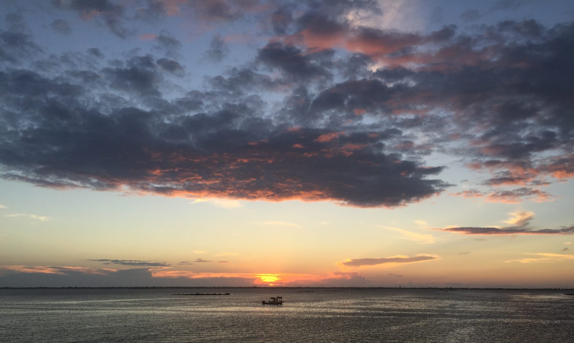
- Views. There is signage all around the viewing deck at the top of Ranger Peak that helps you discern where certain things are located. Like Mexico. Pretty cool! And being a mile high, there’s a lot to see up there!
- Park Staff. Bless ’em, one and all. From Eddie talking to us about the serious nature of hiking in the heat around his mountain to Nicole swiftly rendering me aid to the Tram Operator who yielded his seat, they are all top notch in my book.
- Trails. Man o man, do they ever have some doozies at WAT! There is one that even starts at the parking lot and climbs ALL THE WAY TO THE TOP. That’s some serious climbing! There are others that wind their way around the mountain, like the one we attempted. Word to the wise – the trails are loose rock on a rock mountain. Very tricky with the footing in a lot of spots. Wear grippy shoes and for the love of all things good, carry a TON of water.
Must Do’s
- Tram Ride. Keep your cameras ready, this is a truly great experience and you’ll want to capture some of it on film. Plus, it’s the sole way to get to the top and those fantastic views, unless you plan to climb.
- Hike. Please don’t let our experience dissuade you from some truly remarkable trails with unbelievable views because the next time we are in West Texas, we’re trying that trail to the Crash Site Overlook again. It was one of the best we’ve experienced, even though we didn’t conquer it!
- Hydrate. Pack more water than you think you’ll need. And then double it. Truly, don’t suffer heat-related issues on the mountain. Take a ton of water with you. Just trust me on this one.
We’d love to hear about your experiences at Wyler Aerial Tramway State Park! Please share your experiences at this mile high State Park in the comments.
*In all natural areas, you are a guest. Educate yourself on what lives in the areas before your visits, always talk to the Park Rangers upon arrival and take precautions so that your experiences end as positively as ours.